GR240 – Sulayr trail is over 300 km long long-distance trail stretching around the Sierra Nevada mountain range in southern Spain – Andalusia. On average it goes between 1500 – 2500 meters over the sea level. The total ascent is around 9 km.
HOW TO GET THERE
There are 3 main tourist info points on the trail that can serve as point of departure:
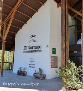
- Centro de visitantes El Dornajo
- Access: by bus/car from Granada
- (connection Granada – Sierra Nevada)
- Description: Building with a café next to a highway and 2 hotels with restaurants in vicinity
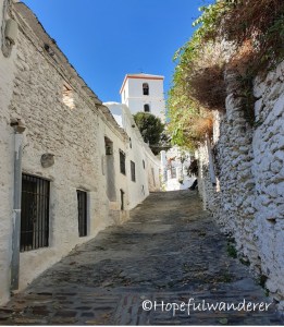
- Punto de información Pampaneira (RECOMMENDED)
- Access: by bus from Granada
- (connection Granada – Pampaneira)
- Description: The info point is located in Pampaneira. Nevertheless, the trail itself does not go through here! It goes through the neighbouring village – Capileira. If you decide to begin in Pampaneira, you have to count with the initial 5 km hike with 400 m ascent. Alternatively, you can arrive by the bus directly to Capileira.
- Punto de información La Ragua
- Access: by car
- Popis: building next to a parking lot. There’s no restaurant (at least we haven’t found any), yet, there’s a ski rental.
STRUCTURE/ORGANIZATION
The trail is oficially divided into 19 stages (19 days). The total distance is around 300 km (according to my own measurement with Suunto watches 315 km but according to a map 290 km). The total time of the hike usually varies between 15 to 19 days depending on personal preference and physical condition. Hiking on average around 20 km per day, we finished the trail in 16 days. However, we had no rest (“zero”) day. I think it is worth pointing out that the official stages sometimes end at odd spots not suitable for camping. Therefore it is often needed to continue a bit further and search for a good camping spot. In general I would say that the trail schedule as set oficially is rather easy. Trained hikers won’t have a problem hiking more km per day or merging some stages into one. On the contrary, for less trained (beginner) hikers the schedule would be likely ideal.
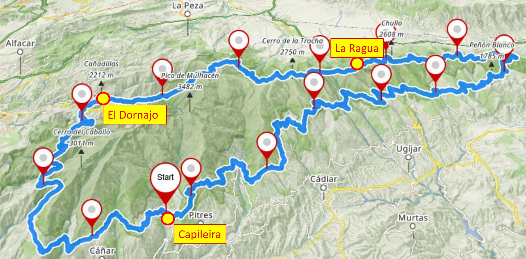
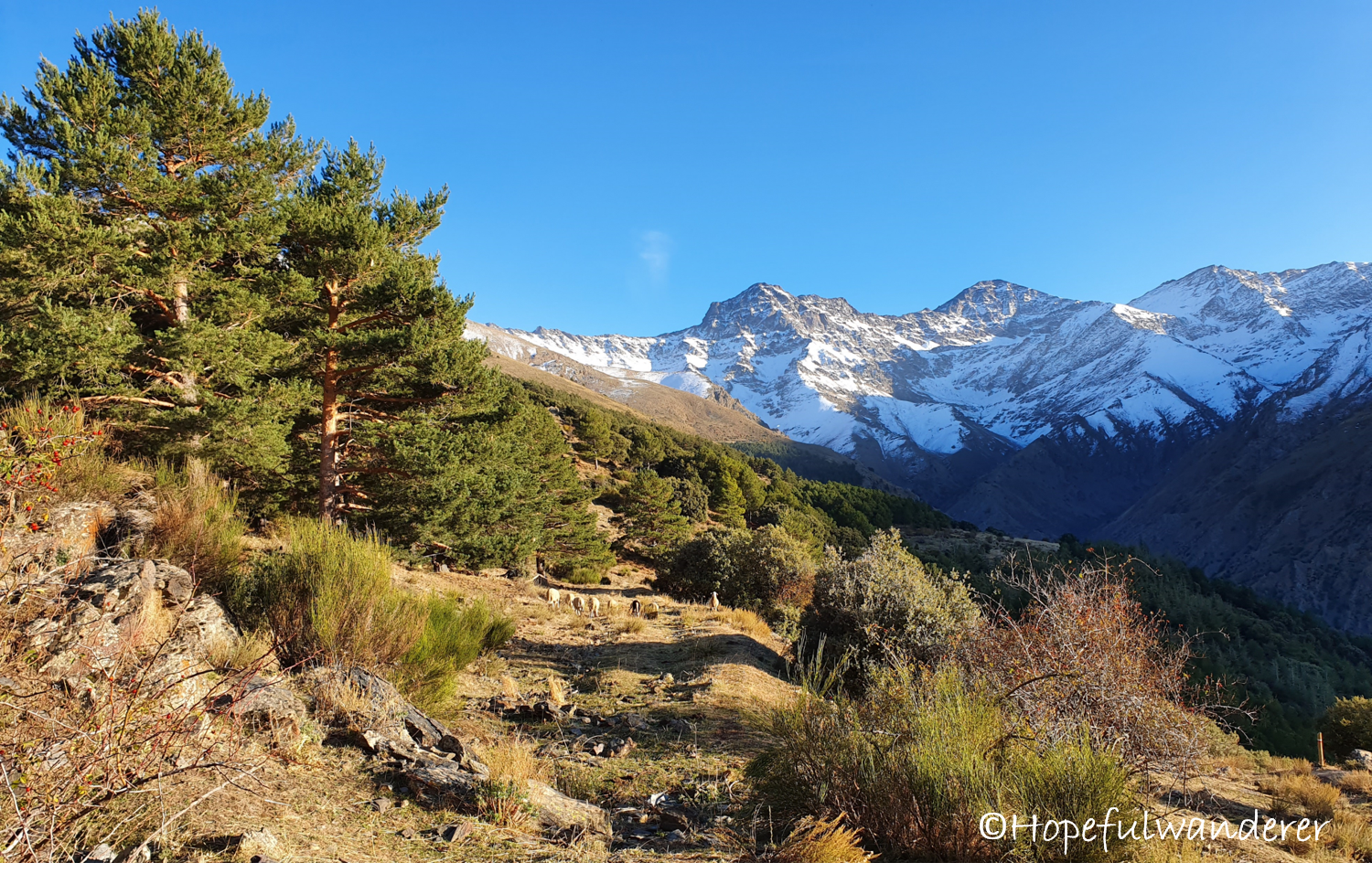
It is possible to go both ways. Departing from Capileira we began our hike on the southern side and headed east. After crossing the eastern tip we found ourselves on to the northern side and continued west. The southern hillside is quite dry, with its dusty roads, cactuses, grasshoppers and spiked bushes it could be described as a dust bowl. Northern hillside, on the other hand, with its rocky terrain, little streams, greenery and snow here and there is rather mountainous. Western part resembles american wild west (cattle – cows and horses, wide dusty roads, creeks, pointy hills, plateaus). Just add a cowboy and you can film a western movie…
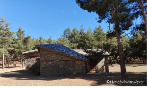
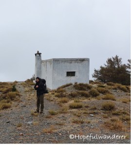
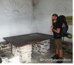
SHELTERS ON TRAIL (REFUGIOS)
We have encountered 8 “emergency shelters” on the trail, where one can spend the night if in need. Typically, the shelter is a stony building with a fireplace and plank-beds inside. Usually it’s not very cosy and hence for an emergency use only. Nevertheless, with bad weather a roof over the head can come in handy.
- Refugio La Polarda – there are actually 2 refugios near La Polarda peak. We headed by chance into the smaller no-name one which lies down the hill opposite to the mountain. This has become the first refugio we have visited and unfortunately also the most disgusting one. I can hardly imagine spending a night there. (stage 7./(12. official), capacity: 5 persons, gratis)
- Refugio Piedra Negra – we didn’t find this one but it exists! We didn’t search hard enough and long enough. It is situated on the right side of a wide path leading to the Piedra Negra peak. (stage 8./(13. official), capacity: 10 persons, gratis)
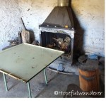
- Refugio Las Chorreras – quite a decent one with a table, a fireplace and beds (stage 10./(15. official), capacity: 10 persons, gratis)
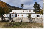
- Refugio Postero Alto – the only refugio you actually need to pay for, yet the comfort you get is certainly worth it. It is more of a hostel than a shelter. We stopped here only for a refreshment but I believe that spending a night here would be a pleasant experience. (stage 11./(16. official), capacity: 68 persons, € 17.50/person/night, http://www.refugioposteroalto.es)
- Refugio Peña Partida – refugio in the best condition with amazing views. We didn’t spend the night here but we should have…(stage 12./(17. official), capacity: 6 persons, gratis)
- Refugio El Calvário – the only refugio in which we actually spent the night. Spacious (3 rooms) with fireplace and many beds. Fumous (poor ventilation) decorated with many interesting “artistic” works on the walls (stage 12./(18. official), capacity: 16 persons, gratis)
- Refugio Tello – the biggest freely accessible refugio with common room and kitchen unit (stage 17./(3. official), capacity: 12 – 20 persons, gratis)
WATER ON THE TRAIL
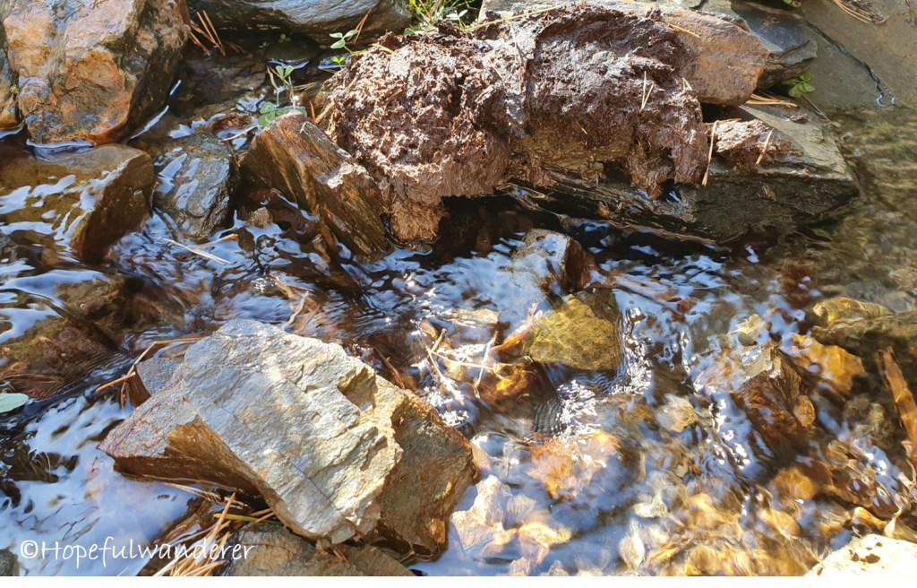
Despite the dryness of the southern hillside there were sufficient water sources on the trail. We were bumping into streams, creeks, rivers and basins all the time (usually 3-4 times a day). I would definitely highly recommend to pack a water filter (I’m using Sawyer squeeze but there are many different solutions on the market) or other tool for water purification. There are many cows and other animals in the mountains that like to poop everywhere (including the water sources) and so we saw many times with our own eyes that even the purest-looking water can be contaminated. We filtered the water always and everywhere.
WHEN TO HIKE:
- September – October
- April – June
Even in October we did have relatively warm weather. The days spent on the southern hillside were very hot, the nights were colder but most of the time the temperatures were above zero. I can’t imagine very well hiking the GR240 in the middle of summer (July, August). I think the heat would be hardly bearable. During the winter (December – February) one would likely have to fight cold and a lot of snow in some parts. Autumn (September – October) or spring (April – June) would be in my view the best choices. In addition, during these months the likelihood of being able to enjoy the spectacular views on the snowy hills while hiking in the shorts in the middle of a warm sunny day is the highest. The day lenght even in October was sufficient. (sunrise around 8 a.m., sunset around 7.30 p.m.)
HOW WAS OUR HIKE? Read more….
- Day 0 – Kid with garlic and almond sauce
- Day 1 – Campsite “By the Pooped Rocks”
- Day 2 – Stalker!
- Day 3 – Thirst
- Day 4 – Hunt
- Day 5 – Shower
- Day 6 – The Grandpa of Sierra Nevada
- Day 7 – Losing our minds
- Day 8 – Civilization
- Day 9 – Fleas? Bedbugs? Or mange?
- Day 10 – What about cross-country skiing?
- Day 11 – Trail magic
- Day 12 – Such a galoot
- Day 13 – Loaded up
- Day 14 – Wild West
- Day 15 – Almost there
- Day 16 – We made it!
