I still don’t get it, I don’t get how come that despite its beauty, this trail is so little known and little frequented…
But such remoteness and wilderness is what we usually look for. It offered us exactly what we were wishing for – peace, silence, a possibility to surround ourselves by beautiful nature and just experience the world around…far away from all the worries, stress and negativity with which we often must deal in our everyday lives.
If you are searching for a similar kind of active relaxation, than Sulayr trail is the right place for you. I’m sure you would absolutely love this sunny path leading around the most spectacular Spanish mountains.
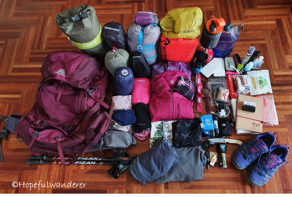
GEAR
All in all, I was happy with what I packed and I did not miss almost anything. I just didn’t really expect to be dealing with snow and so I didn’t pack gloves. Luckily Thomas had 2 pairs, so I could borrow them. Next time I would pack both the gloves and warmer hat (I only had a light merino hat, which is rather a base layer. Often I was really grateful for a hood on my feather jacket). There were some places on the trail where crampons could come in handy but I wouldn’t say they are a necessity (we didn’t have them either).
PLAN
We dived in head first without preparations (partly because there was very little information available about the trail…at least in English). Nevertheless, a bit of planning would not hurt. If you are thinking about going, check out the basic information about the trail, the map and individual stages. Chose your point of departure, find out how to arrive there and think about re-supply points along the way.
Should you want to follow in our footsteps, go by bus from Granada to Pampaneira and from there hike to Capileira where you reach the trail. Re-ssuply in Tréveléz and Abrucena.
MARKINGS
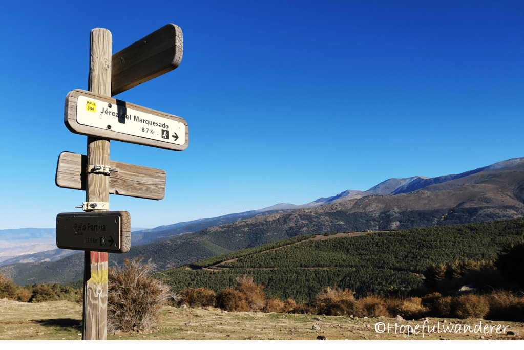
The trail is very well marked and the orientation is easy. Although we typically like to have a paper map with us, we didn’t have any as we didn’t get one of a suitable scale that would cover the whole trail. We got away with just a digital offline map downloaded from mapy.cz. It happened to us few times that the map differed slightly from the physical markings, few times the map was also showing a stream that was not there but most of the time the map was pretty accurate and totally sufficient for the trip.
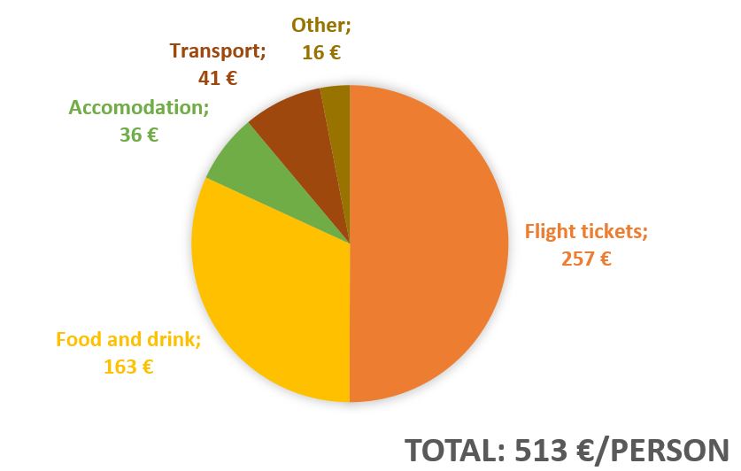
BUDGET
RECOMMENDED PLACES
- Mesón Rural Alberto (restaurant), Pampaneira
- El Jardín de Sabores (restaurant), Capileira
- La Alacena (tapas bar), Capileira
USEFUL PHRASES
- “Hola” = “Hi” (informal)
- “Buenos Días”= “Hello” (formal)
- “Disculpe pero no comprendo (bien)” = “Sorry, but I don’t understand (very well)
- “¿Puede/puedes darnos agua, por favor?“ = “Can you give us water please?”
- “Coto privado de caza” = “Private hunting ground”
- “¿Hay alguién por aquí?” = “Is anyone here?”
- ¿Podemos comprar algo aquí?“ = “Can we buy anything here?”
QUESTIONS?
Please feel free to reach out any time! 🙂

This is brilliant,so useful, I might reach out with questions as we plan to do this route possibly this year x
LikeLike
Good choice, Ann! This trail is magnificent. I´m glad you found my summary useful 🙂 Feel free to reach out anytime (either here or via email – hopefulwanderer.k@gmail.com). Happy to share my experience.
LikeLike
Hi, thanks for this amazing guide. Question… you completed the trail in 16 days and almost nowhere to resupply, so you were carying something like 16 days of food, snaks???
LikeLike
Hi Rob, we made 2 resupply stops actually – first one in Treveléz (right on Day 2nd) and second one in Abrucena (Day 8th). Treveléz is right on the trail, to get to Abrucena we had to do like 5 km road-walk. Hope this helps! 🙂
LikeLike
Thanks Kristyna, food is so… important… So I will surely start from Guejar Sierra, first resupply Trevelez and then Abrucena. Thanks a lot and keep walking 😉
LikeLike